Rain is here—do you make it work for you?
When rain falls, how you guide it decides between growth and damage: if water stays in the soil, life expands; if it rushes off, you get dry spots and erosion. Water is the key resource on our slope—so we slow it down, let it sink in, and make it work. In this article, we show our simple setup: shallow swales hold moisture, a gentle diversion trench moves excess safely, and a small pond stores water and creates habitat.
You’ll learn how to read natural water paths, set the right gentle grade, design safe overflows, and avoid common mistakes—so rain becomes stored water that steadies soil, plants, and the microclimate.
Table of Contents
How We Proceeded
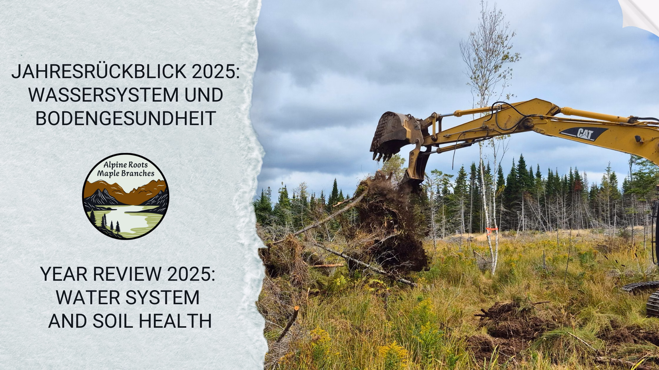
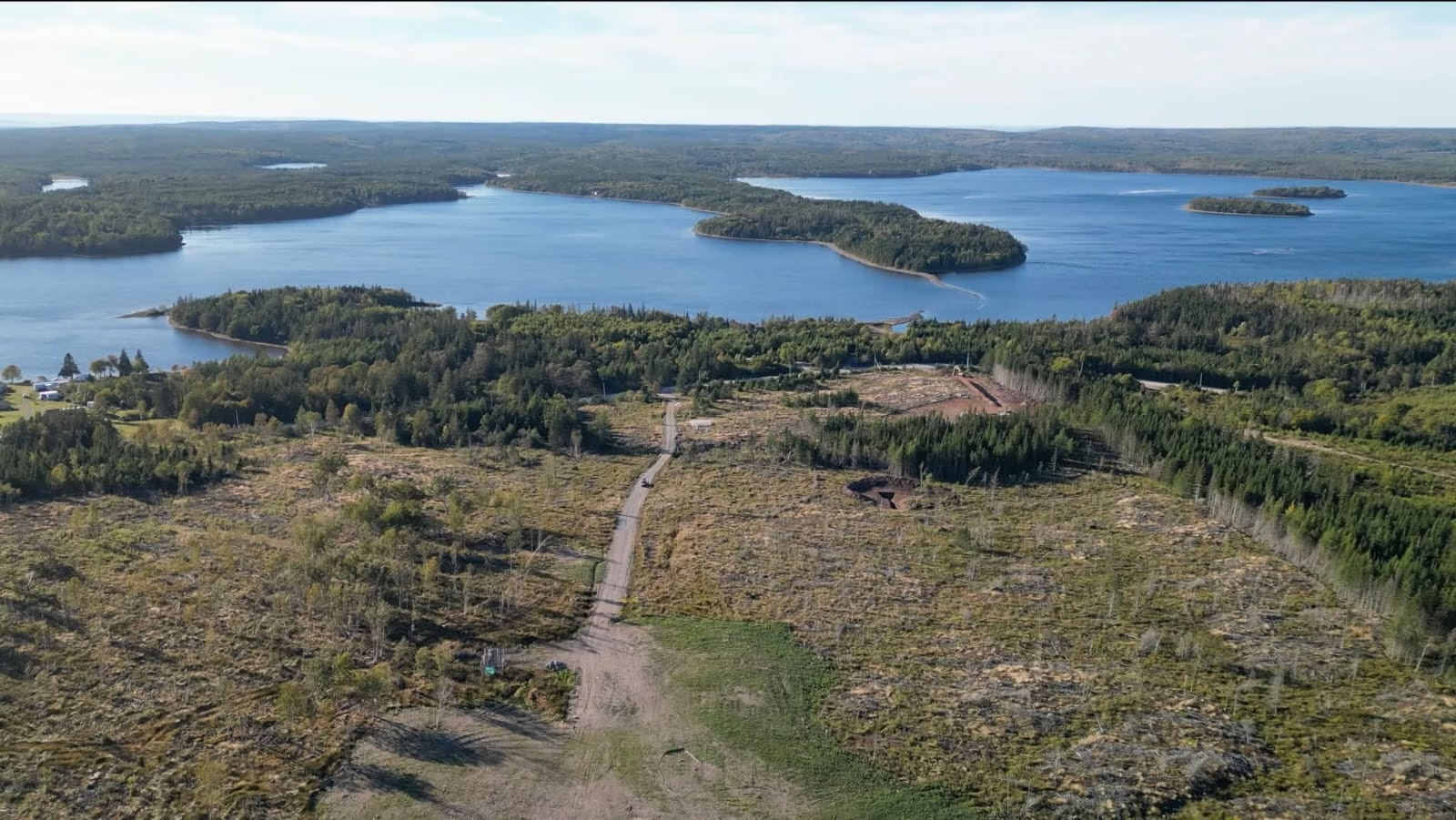
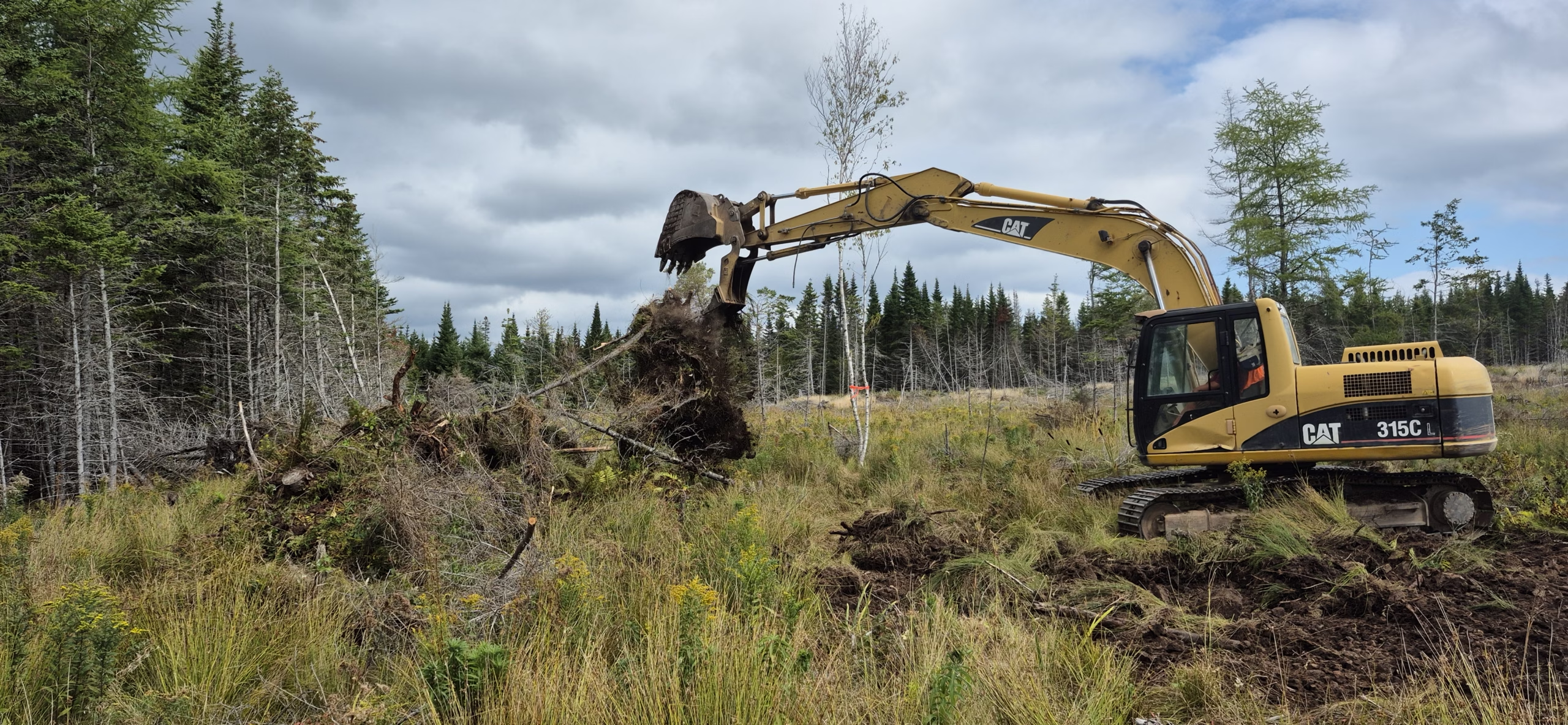
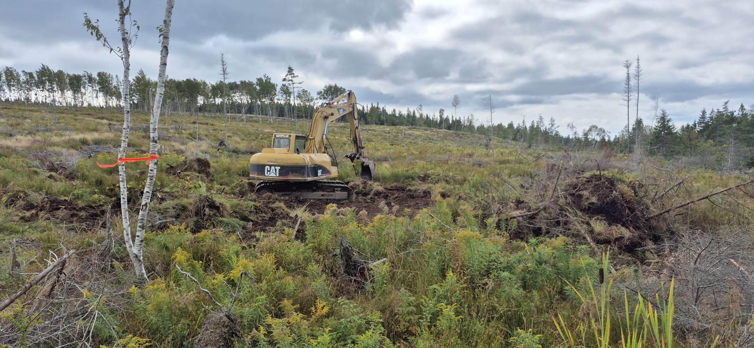
We spent a full year working this slope not with machines, but with eyes and patience. Gernot kept returning to different vantage points on our land to watch what nature does: where water chooses to run during rain, how the soil’s structure sets highs and lows, where natural collection points form, and where that creates perfect spots to catch and store water—then let it move on gently as overflow without drying out other areas. Because we still don’t have a fixed residency permit, we only start projects when they come together organically. A lot happens through lucky timing and Gernot’s local networking. When neighbors already have an excavator on-site, we piggyback to save travel costs and only move as much earth as the current budget allows. This week our second pond was completed. Together with diversions and safe overflows, it’s the backbone of a water system that stabilizes our young permaculture, recharges soil moisture, and creates habitat.
Why Water Comes First
Water is the quiet infrastructure of a living landscape. When rainfall isn’t allowed to rush off but is slowed, spread, and held in the ground, it builds a moisture buffer that feeds roots, activates soil life, and keeps plants stable through dry spells. Every millimeter lost on the surface is missing later in the root zone.
This year drove it home: nearly 16 weeks without meaningful rain. Sometimes a misty drizzle, but so little it didn’t even wet the very top soil layer reliably. In such phases a good water system decides whether young plantings survive, whether soil organisms stay active, and whether the slope holds. Without stored and infiltrated water each day gets drier, vegetation gaps open, and soil structure and life decline.
Water is moving energy.
When stormwater turns into surface runoff and rushes downhill unimpeded, it can slice into soil, carry off fine particles, and form rills.
That happens even on a meadow—often in patches rather than across the whole surface. Triggers include saturated or compacted spots, game and foot paths, tire tracks, old logging lanes, molehills, frost cracks, or water-repellent crusts after long droughts. Water gathers there, speeds up, and concentrates its force. Small fans become notches, notches become rills.
If we guide and slow the water instead, that energy works for us. Water spreads, infiltrates more gently, reaches more of the root zone, and fills fine pores that would otherwise stay dry.
More moisture remains where plants need it, erosion drops, and with each rain event the soil becomes more stable and better structured.
Water shapes microclimate.
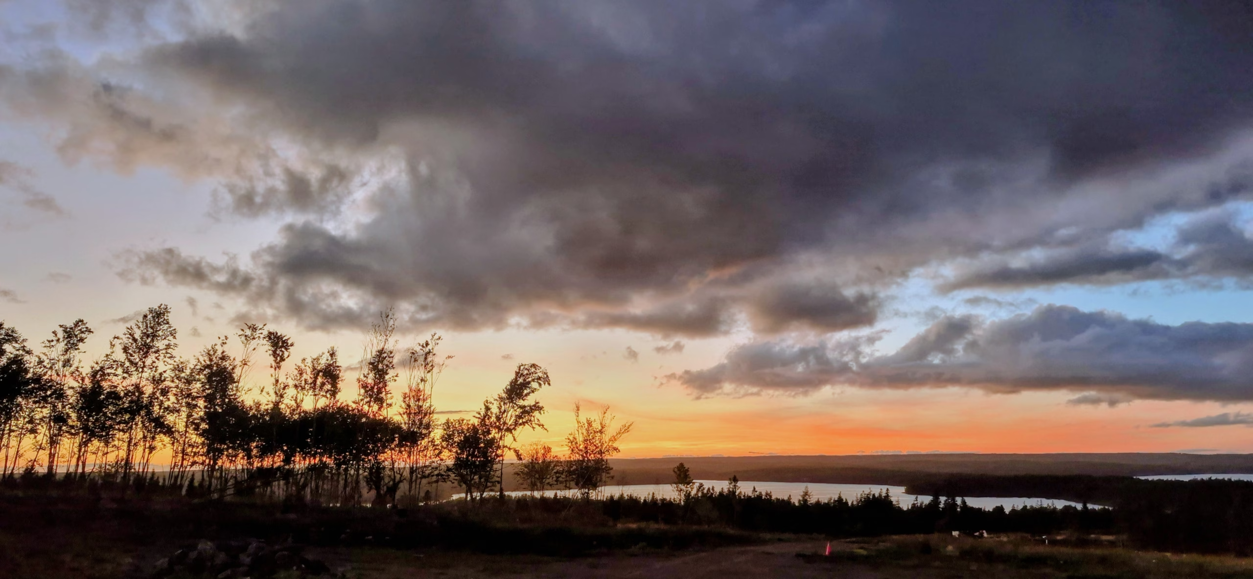
Ponds and wet swales store heat, give back evaporative cooling, and soften extremes. In summer they buffer heat; in fall they extend the mild window in which plants can still grow and build strength. That takes stress off plants and reduces pest pressure.
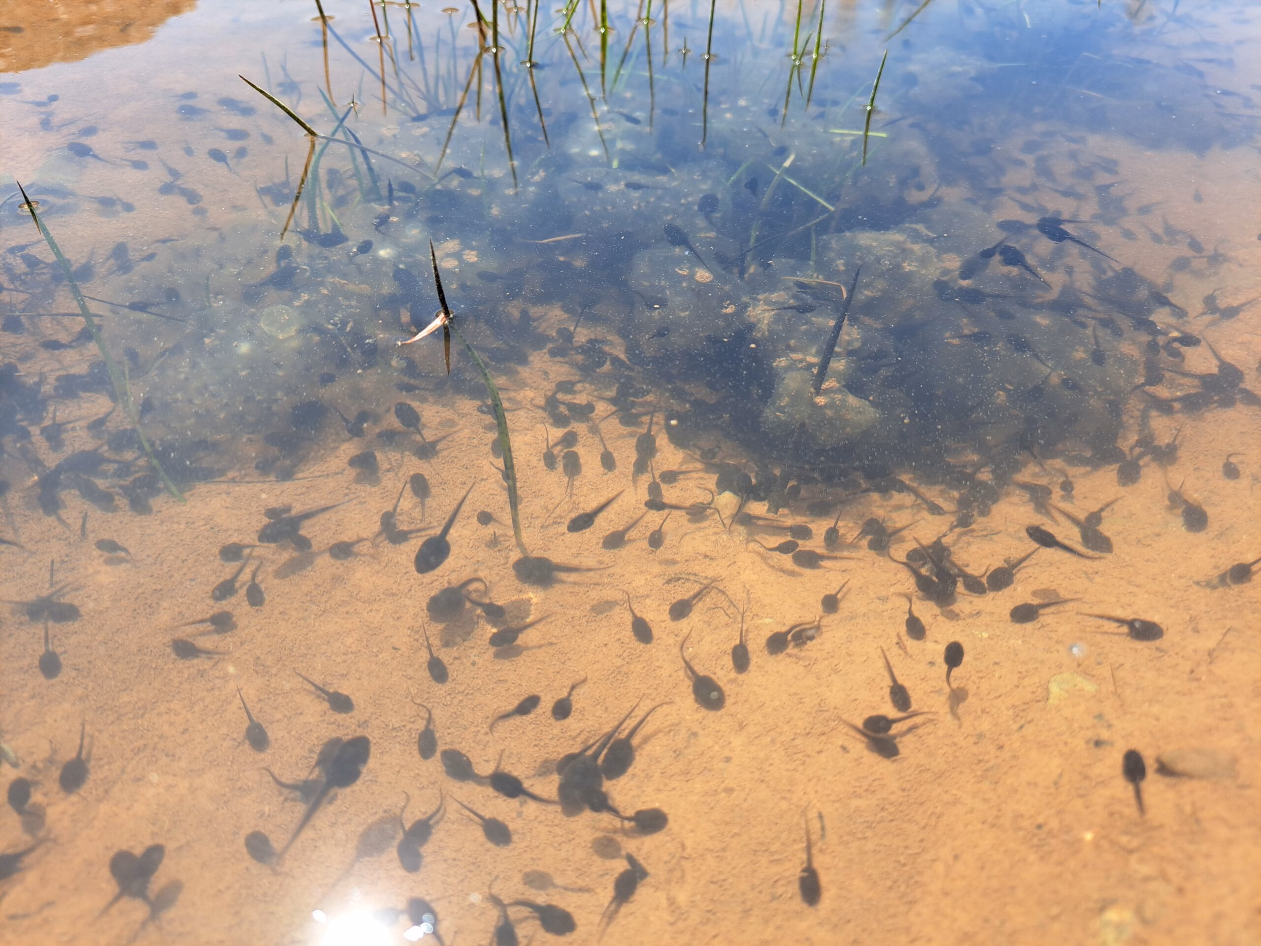
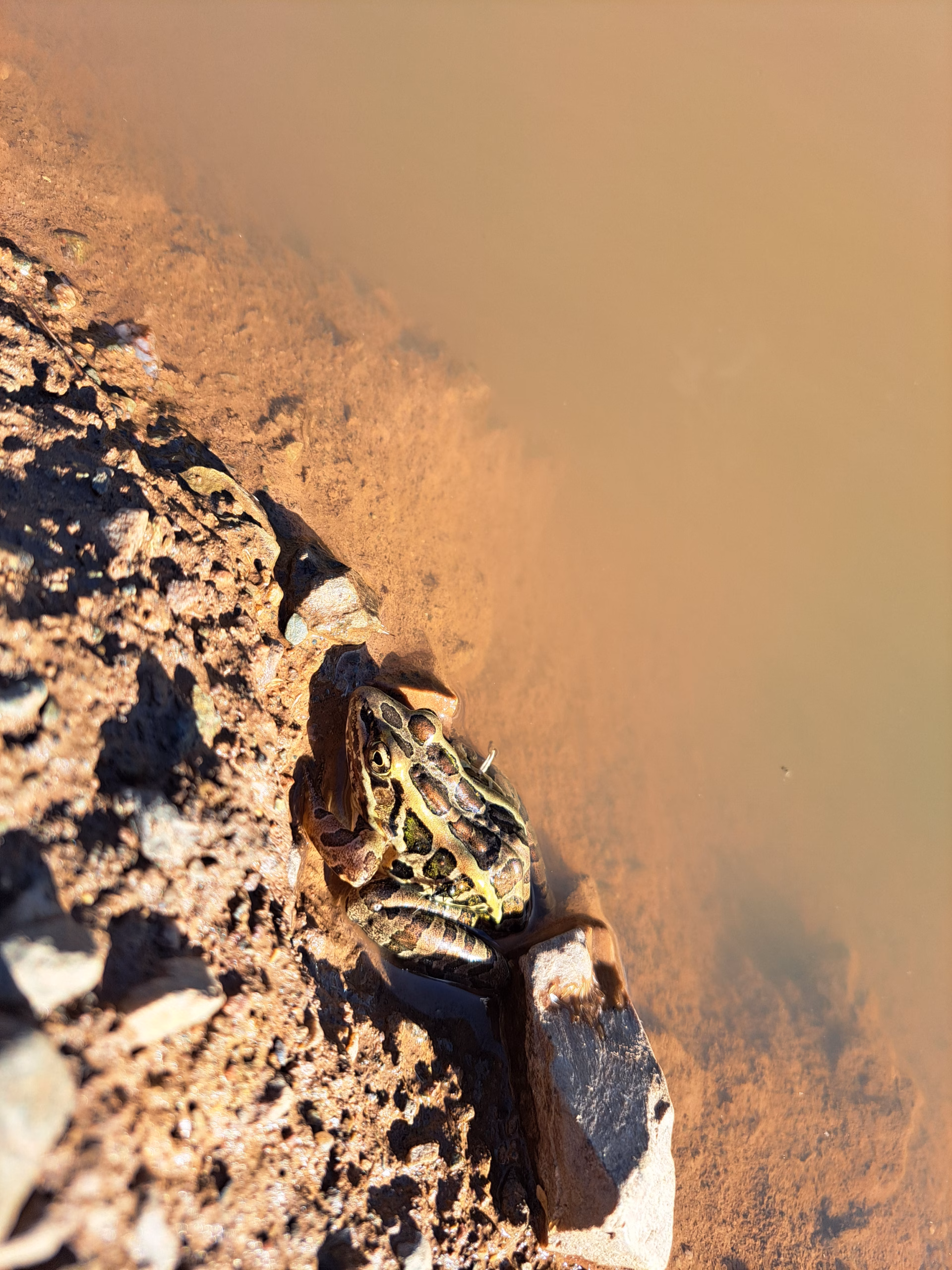
Where water is, life moves in. Even a small pond becomes a drinking spot, a nursery for amphibians, and hunting ground for dragonflies and birds. Narrow wet strips along a swale connect habitats like stepping stones. The more diverse these moist patches, the more stable the whole system becomes because beneficials find shelter, food, and breeding sites.
In the end, water design saves work. If you harvest rain smartly, you irrigate less, repair fewer erosion scars, and the soil starts working with you. That’s not romance—that’s resilience. A landscape that can conduct water handles weather swings with fewer external inputs.
Reading the Slope Before Digging
Earthworks are costly and have side effects. Reading the slope first avoids a lot of rework. Working with nature means using what’s already there: contours, hollows, ridges, and the routes water naturally takes. Forms that fit the slope rather than forcing it mean less excavation, fewer accidental wet spots, protection from undercutting, and intact soil horizons—the natural layers with their own colors, structures, and functions, from humus-rich topsoil down to mineral subsoils—where soil life can keep doing its job. Every element gets a safe overflow path so energy never escalates out of control but goes where it helps.
How we do it in a few clear steps
Find contours with an A-frame or water level.
An A-frame is a simple wooden “A” with a string and a little weight as a plumb. Set it down, center the plumb on the mark, and you’ve found equal height under both legs—a point-to-point contour.
A water level is a clear hose filled with water; the water line sits at the same height at both ends, letting you match horizontal points over distance.
Contour lines are imagined lines of equal elevation. Along them there’s no sideways fall, so water initially “rests.”
Map flow paths after strong rain and mark temporary rivulets.
We hammered in leftover, broken trunks from nearby clearing as posts and tied bright ribbons to them. From afar and with the drone those lines were easy to spot and re-find, showing where flows converge.
Estimate catchments and what drains where.
Practically, we ask which area feeds Pond A, where Pond B makes sense, and whether volume is enough—or whether a Pond C is needed as a buffer. Roofs, tracks, and compacted areas count to the catchment because they deliver more and faster water than meadow or forest.
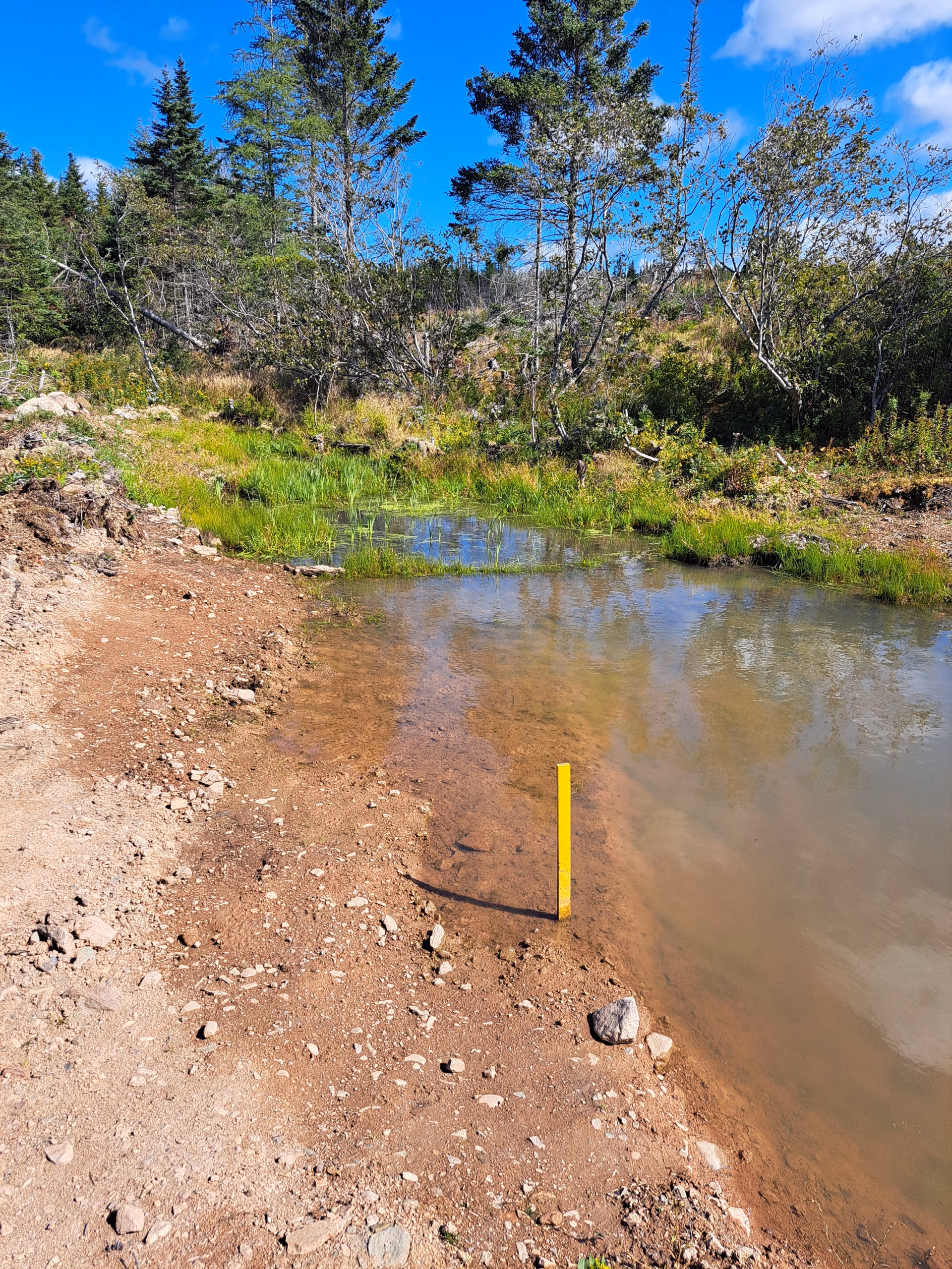
Plan a safe exit for every element with a leveled overflow.
That matters because during cloudbursts you want water to leave evenly and harmlessly. One of our ponds sits near the road; the overflow must be set so it never undercuts or washes the road if the level rises quickly.
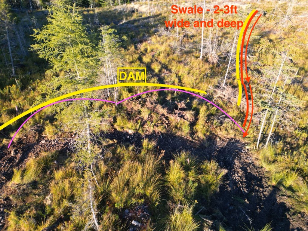
Swales, Diversion Drains, and Ponds Working Together
Swale
A swale is a shallow, vegetated trench exactly on contour. That means the swale’s bottom sits at the same level along its length—no tilt left or right—so water is slowed evenly and can soak instead of running off sideways. Width matters more than depth: go shallow and wide and get it vegetated quickly so it holds its shape. At the swale’s upslope rim sits a leveled overflow, often called a spillway, a flat crest at one even height that releases surplus gently into the next element.
Diversion drain
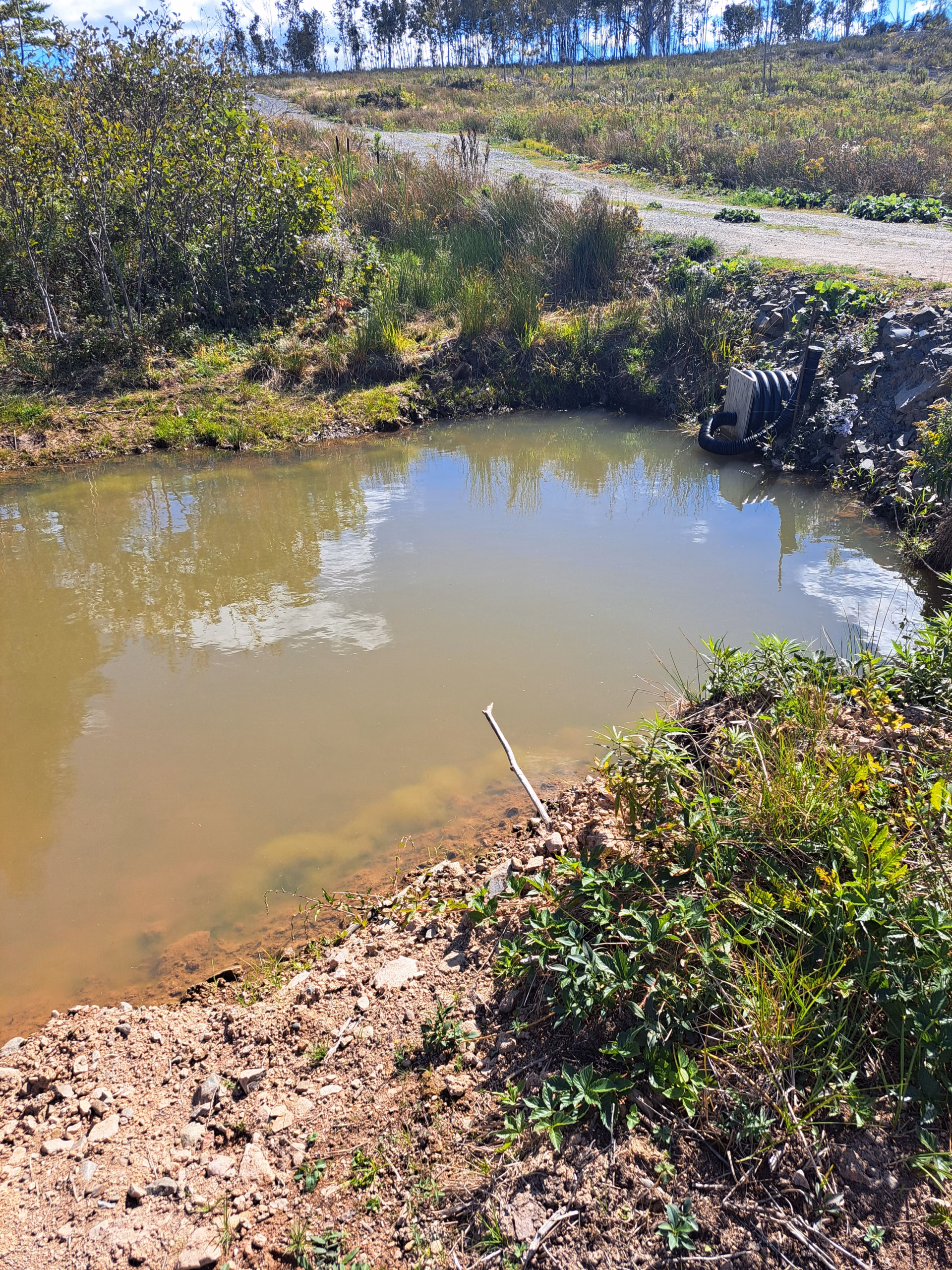
A diversion has a minimal, precisely set fall. Its job is lateral steering: it captures water above sensitive areas and leads it sideways to a safe spot, like a pond or strong turf. Because there is flow, banks need to be stable and transitions armored where needed. It’s not a disposal ditch; it’s a control tool that shaves peak flows and redistributes water in space and time. On our land the drain intercepts water that would otherwise rush along the boundary ditch to a culvert and straight to the lake—the fastest exit, but wasted for soil and plants. Now the drain holds it on our property, routes it through the whole water system, and only then lets it head to the lake.
Pond
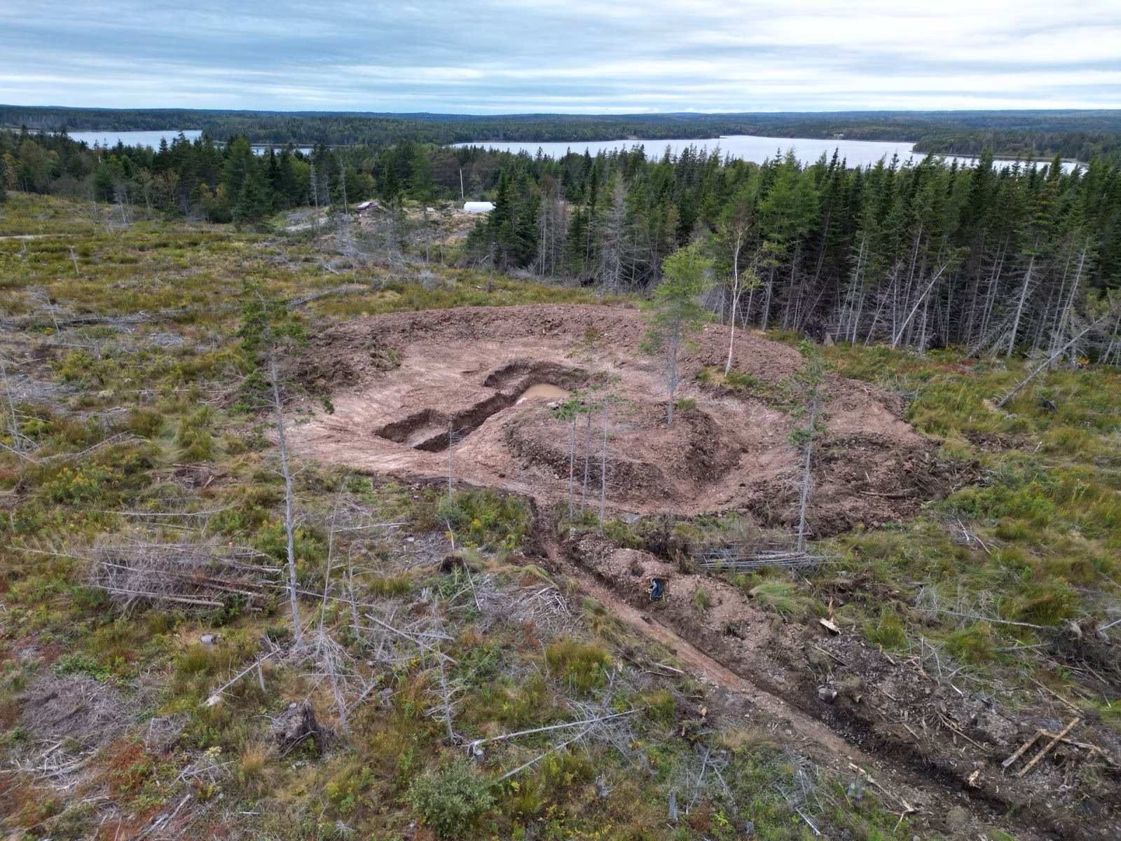
The pond is storage, habitat, and thermal mass. It sits where natural lines converge, without destabilizing slopes. The overflow is broad, level, and protected so nothing scours out in storms. Where possible, forebays settle sediment before it reaches the main body. We shaped gentle shelves and ramps along the edge so animals can climb out. That also creates distinct zones—shallow for insects and juveniles, medium depths for many aquatics, and deeper pockets as cool refuges. A practical note for daily life: our dog Diana has a weak hip and can’t swim well but loves water, so every pond needs a very shallow paddling shelf for her. A well-set pond marries function with real habitat—for wildlife, crops, and us.
How We’re Building on the Slope
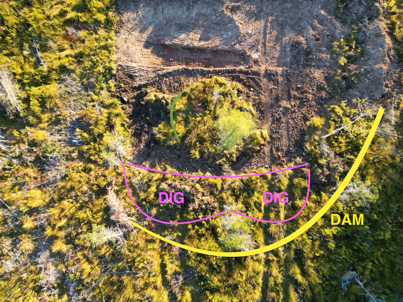
We don’t start with the biggest hole; we start with the clearest picture. Months of watching pointed out the collection points.
We shaped inlets so water enters gently and fine material drops out in small fore-zones.
The outflow currently follows the same natural drainage that existed before—only now a pond sits in front of it, catching, calming, and buffering peaks before the water moves on.
Step by step this grows into a connected water system, not isolated pieces.
Usually you build ponds from the highest point down, one element after the other. We’re working bottom-up for practical reasons. If the excavator had to spend half a day reaching a remote upper corner first, we’d have only six hours of digging left instead of twelve—and get only a fraction of the needed pond volume. Starting with the accessible lower area gets the biggest impact in the time we have, and we’ll tie in the upper elements later.
Quick field notes
- A-frame over laser when budgets are tight
- Forebays pay off with less muck in the main pond
- Plan, mark layout and overflow first—then dig
Step by Step: Planning a Diversion Drain
Set the goal
Peak shaving, road protection, feeding the pond laterally, or relieving sensitive zones. Clear goals set route, length, depth, and the safe discharge point.
Route and grade
Use a very gentle fall—millimeters per meter. That keeps flow slow and spreads water sideways instead of building energy. Let the line follow the slope’s shapes to minimize excavation. Avoid pockets where water would stand unless you want them.
Cross-section
Prefer shallow and wide to deep and narrow. Broad, low-energy flow protects banks and is easy to walk across.
Outlet
Plan it first. Ours discharges into the pond, so the drain shaves peaks and sidesteps the boundary ditch and road.
Transitions
Where flow speeds up—bends, entries, outlets—use flat, even crests and, if needed, coarse material to stop scouring. Keep all drops low; no surprise waterfalls.
Vegetation and stabilization
Give the surface texture so water brakes. Allow pioneer cover; add native grasses or groundcovers later if needed. Aim for dense roots that lock the shape.
Maintenance and monitoring
After storms, check for debris at the entry and minor scour at edges. Fix early. A clean entry and defined outlet are half the life of a diversion.
Safety and the road
Because one pond sits near the road, a planned overflow path is crucial so no storm flow ever undermines the road. The diversion routes water away from the road and into the intended area.
Sealing a Pond – Our Experience and Your Options
We were lucky: heavy clay subsoils. The test pit held water, so no extra seal was needed—freeing budget and machine time for placement, overflows, and clean inlets. If your soil is sandy, gravelly, or cracked, give the pond a hand:
1) Build a “puddled clay” liner
Level the base and remove stones. Place clayey soil in 10–15 cm layers. Bring each layer to field-moist—formable but not smeary—and compact firmly before adding the next. At the banks, roughen the native soil and cut small steps so the clay layers “lock in” and don’t slip. Under the future berm, dig a shallow trench and fill it with dense, compacted clay as a stopper. Aim for 20–30 cm total clay liner. It’s hard work, but very reliable.
2) Use bentonite
Sodium bentonite swells and seals pores. Spread evenly—about 1–5 kg/m² depending on soil—work it into the top 10–15 cm, moisten, and compact. Alternatively, lay overlapping bentonite mats and bury the edges.
3) Biological “gley”
Under low oxygen, a slimy barrier can form. Lay dense, wet organic matter like manure or silage, cover with clayey soil, and keep moist for weeks. Slow but mineral-oil free and partly self-healing.
4) Membranes
If good clay is scarce or time is short, EPDM or HDPE liners work well. Use a protective geotextile, lay with overlap, weld or glue seams per spec, anchor the edges in a perimeter trench, and cover lightly to protect from sun and temperature swings.
5) Details that keep things tight
A compacted core in the berm stops seepage underneath. A broad, level overflow spreads force before it ever works on the berm and sends surplus into the existing natural drain. Keep banks shallow so the liner holds and wildlife can exit. Clear sharp stones from edges and keep debris out of the overflow area.
6) Test and touch up
Fill slowly and watch the level for days. Mark any seep, lower the water, re-compact or add bentonite locally. Only once the level is stable do final edge shaping and fill.
What’s Next
Our second pond is more than a hole with water. It’s the start of a connected system that slows, spreads, and turns rain into living soil. After a summer with almost 16 rain-free weeks we feel how essential these stores and gentle diversions are—for plants, for wildlife, and for us.
Next we’ll add the upper elements, watch flow paths during storms, and fine-tune inlets and overflows. What we won’t do is fight the slope. We’ll keep reading the land, observing, documenting, and building with what’s there. Step by step, a system grows that protects in wet years and carries us through dry ones.
If you’re curious about any detail or unsure at a specific step, drop us a line in the comments. What have you tried with swales, diversions, or naturally sealed ponds?
Sources
- FAO – Water Harvesting (Runoff Farming)
https://www.fao.org/fileadmin/templates/cpesap/C-RESAP_Info_package/Links/Module_5/Water_harvesting.pdf - FAO – Introduction to Water Harvesting
https://www.fao.org/fileadmin/user_upload/agwa/docs/bari2017/Session3/Harvesting_Introduction_I.pdf - USDA NRCS – Diversion (Code 362)
https://www.nrcs.usda.gov/sites/default/files/2022-09/362_NHCP_CPS_Diversion_2021.pdf - USDA NRCS – Pond (Code 378)
https://www.nrcs.usda.gov/sites/default/files/2022-09/Pond_378_NHCP_CPS_2022.pdf - Ohio EPA – Level Spreader
https://epa.ohio.gov/Portals/35/storm/technical_assistance/6.2_Level_Spreader.pdf - Chesapeake Stormwater Network – Level Spreader
https://chesapeakestormwater.org/wp-content/uploads/2022/07/3272-3.pdf - FAO Africa Training Manual (Vetiver)
https://www.vetiver.org/FAO%20Africa%20Training%20Manual%2008water.pdf - Yeomans, P. A. – Water for Every Farm (Keyline)
https://soilandhealth.org/book/the-keyline-plan/
Reprint PDF
https://cheiodasideia.libertar.org
